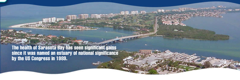
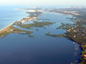
 Sarasota Bay is not a classic "drowned river valley" estuary like Tampa Bay. It is a coastal lagoonal system formed by a necklace of barrier islands to the west and the mainland of Manatee and Sarasota Counties to the east. Sarasota Bay is not a classic "drowned river valley" estuary like Tampa Bay. It is a coastal lagoonal system formed by a necklace of barrier islands to the west and the mainland of Manatee and Sarasota Counties to the east.
This coastal lagoon, with its unique ecological character of small embayments, tidal tributaries and small creeks, coves, inlets and passes, is bounded by Anna Maria Sound to the north and stretches all the way to just north of the Venice Inlet, which serves as its southern boundary.
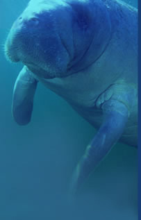
More than 1,400 different native species of plants and
animals inhabit the Bay area.
Bay Statistics:
Watershed size - 455 square miles
Length – approximately 56 miles long
Average depth – 6.5 feet
Population – approximately 600,000
Embayments
Sarasota Bay is made of a series of smaller bays or embayments. Each of these embayments are unique from one another. They differ in overall size, shape and water depth, shoreline features, habitat and sediment characteristics. These unique characteristics lead to differences in water circulation, freshwater inputs, nutrient loads, as well as other consequences for health and vitality. Because of these differences, each embayment must be analyzed and managed independently from the others at the same time recognizing their connectivity.
The Sarasota Bay Estuary Program recognizes the following embayments as having their own unique set of conditions and influences: Palma Sola Bay, Sarasota Bay proper, Roberts Bay, Little Sarasota Bay, and Blackburn Bay
Tributaries
Tributaries are creeks or streams that gather stormwater from the adjacent lands (watershed) and discharge it into a particular embayment. The primary tributaries and their adjoining embayment in Sarasota Bay are: Bowlees Creek, Whitaker Bayou and Hudson Bayou (Sarasota Bay proper), Phillippi Creek (Roberts Bay), Catfish Creek and North Creek (Little Sarasota Bay), and South Creek (Blackburn Bay).
Water Atlas www.wateratlas.usf.edu
|